Republic of the Marshall Islands | 12°14′N, 170°08′E | July 29th, 2025
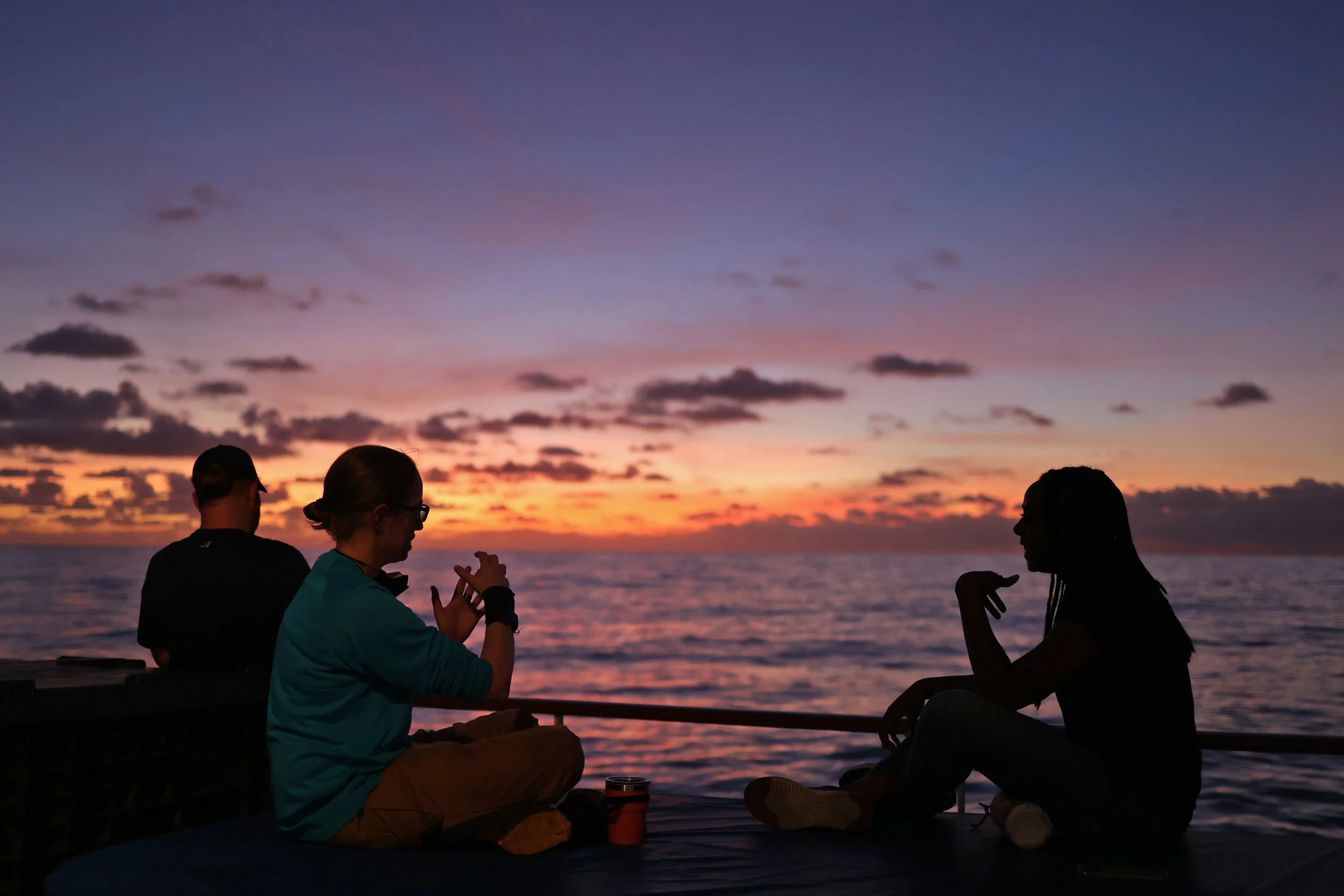
A rush of cool air hits me as I push open the door that leads from the humid social deck into the mess. It’s 11:25am on board E/V Nautilus, which means our shipmates are already congregating for lunch. Gabby Espino stands in line, glued to her phone. When she glances up, her eyes are wide.
“There was a massive earthquake on the coast of Russia,” she says. “And now Hawaii is under a tsunami warning.”
I immediately ask Gabby if she has been in touch with her parents in Honolulu. She nods nervously. Just about everyone on board has friends and family in Hawaii, not to mention other Pacific islands, and the west coast of the United States, all of which could be impacted. While a tsunami is not a concern for our vessel – we are too far out to sea to even feel it – it’s a great concern for our loved ones on shore.
Val Finlayson, a co-lead scientist of this expedition and our resident marine geologist, is standing behind Gabby. Val is not an earthquake scientist, but she is easily the most knowledgeable person on board when it comes to geophysics.
“Magnitude 8.8 is huge,” Val says, leaning in closer to peer at Gabby’s phone. “That’s one of the biggest on record.”
Val has joined our team because her research revolves around piecing together the tectonic puzzle of the Pacific Ocean Basin. As a geochemist, collecting rock samples from the seafloor allows her to examine isotopic "fingerprints" of ancient lava flows.
I’m curious to learn more about Val’s background and expertise, but the potential impending tsunami is the sole focus of our attention right now.
“We can track it,” Val says quickly. “We’ll know as soon as it hits the buoys.”
She’s referring to the Deep-ocean Assessment and Reporting of Tsunamis (DART) buoys that NOAA has strategically placed around the Pacific to help monitor earthquake and tsunami activity.
After lunch, Val pulls up the USGS earthquake tracker and we scroll through the webpage for the NOAA Tsunami Research Center at the Pacific Marine Environmental Laboratory. We spend the remainder of the afternoon refreshing websites and waiting for updates. When it comes to natural disasters, tsunamis are strange – there could be devastating flooding or the tide could just come in a bit higher than usual.
Despite the magnitude, the force generated by the earthquake dissipates during its journey across the Pacific. No serious damage is reported. We all breathe a sigh of relief.
“It was a stressful few hours – watching and waiting and wondering,” Val says. “Everyone wants an earthquake prediction tool, but we don’t have it. There’s just no way to do it. You can forecast based on statistics and probabilities, but you cannot predict exactly when an earthquake will occur.”
After spending much of the day contemplating the nature of earthquakes and tsunamis, I recall a line I read years ago: Geologic time is now.
While we cannot control when the earth will discharge destructive forces, we can seek to better understand their origins. It’s one of the objectives of this expedition and it’s a topic I’m excited to discuss with Val.
---
When I sit down to interview Val a few days later, we start at the beginning.
“Did you always want to be a geologist?” I ask. “Were you the kid that was picking up rocks all the time?”
Val laughs. “Yeah, I definitely picked up lots of rocks as a kid.”
Growing up near Flint, Michigan, she and her family spent part of every summer on Lake Superior. Val is quick to point out that area contains all kinds of glacial deposits from the most recent ice age.
“I was always fascinated with the outdoors,” she says. “My childhood happened before we had the internet.”
When she went off to college at Michigan State, Val was undecided on a major. She ended up in the earth science department, concentrating in meteorology, but her heart wasn’t in it. She elected to take a one-hour credit class that included a spring break field trip to Death Valley.
“It changed my life,” Val says matter-of-factly. “I decided while I was there that I was changing my major.”
For Val, the trip illustrated what a future in geology could look like. She loved the adventure component – spending all day outside, hiking across rugged terrain, and sleeping in tents. She appreciated the in-depth conversations with the professors who were leading the trip, and their willingness to share insights and advice about career possibilities.
But the most striking part of the experience – what ignited Val’s passion and continues to blaze bright many years later – was the rocks themselves. Holding pieces of geologic time in her hands. Contemplating how those pieces fit together.
“I think it was just being in it,” she says. “Being able to pick up the rocks, take a close look at them, and start to translate that into a story about time.”
Val’s words remind me of a favorite passage from Annals of the Former World by John McPhee:
Rocks are the record of events that took place at the time they formed. They are books. They have a different vocabulary, a different alphabet, but you learn how to read them.
This is Val’s job – cracking into the dense volumes of earth’s history, one rock at a time, and translating their complex interiors into a narrative. Using the tools of geochemistry and isotope analysis, Val and her colleagues aim to fill in some missing chapters in the epic saga of our dynamic planet.

Know how to pick ‘em: Val examines rocks on the seafloor from her seat in the Control Van.
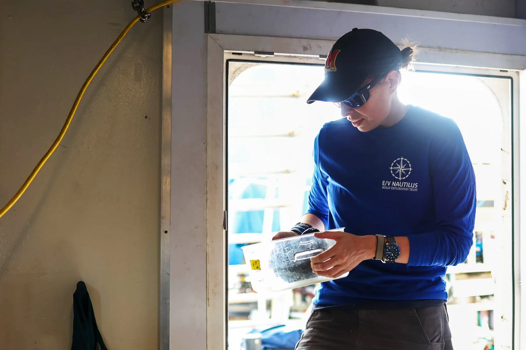
Precious cargo: Val brings a fresh sample from ROV Hercules into the Wet Lab.
Plucking a rock off the seafloor with an ROV may appear simple – find a rock, pick it up, place it in the sample box, and bring it up to the surface.
Setting aside the training of our highly-skilled ROV pilots and the complex engineering that allows us to access the seafloor in the first place, the process for obtaining rock samples is far from simple.
For starters, all the rocks on this part of the seafloor look the same, coated in thick, black ferromanganese crust. But Val is hunting for a specific kind: igneous rocks formed from volcanic activity millions of years ago. They can have a distinctive shape – slightly triangular, like a wedge – that has to do with how the lava flow broke apart once it cooled.
“Lava cools from the outside in,” Val says. “So you get these weaknesses inside the rock where it will break once it’s completely cooled and solidified.”
Selecting the right shape doesn’t always yield the results Val is looking for. “It’s not perfect,” she says. “Sometimes you get a really beautiful angular rock, but when you open it up, it’s all ferromanganese or sandstone.”
The priority is lava, but other rocks provide valuable context for the area. From non-igneous rocks, Val can glean information about what happened after the volcano finished erupting, like the growth of a coral reef.
While rocks are abundant, several of our ROV dive locations include outcrops that are so encrusted with ferromanganese that they are cemented to the seafloor – we can’t move them at all.
“I’ve never seen rocks so stuck to the seafloor,” Val says. “This is the most challenging area for geological sampling I’ve ever encountered.”

Slice and dice: After a successful ROV dive, Val uses a rock saw to cut into her samples from the seafloor.
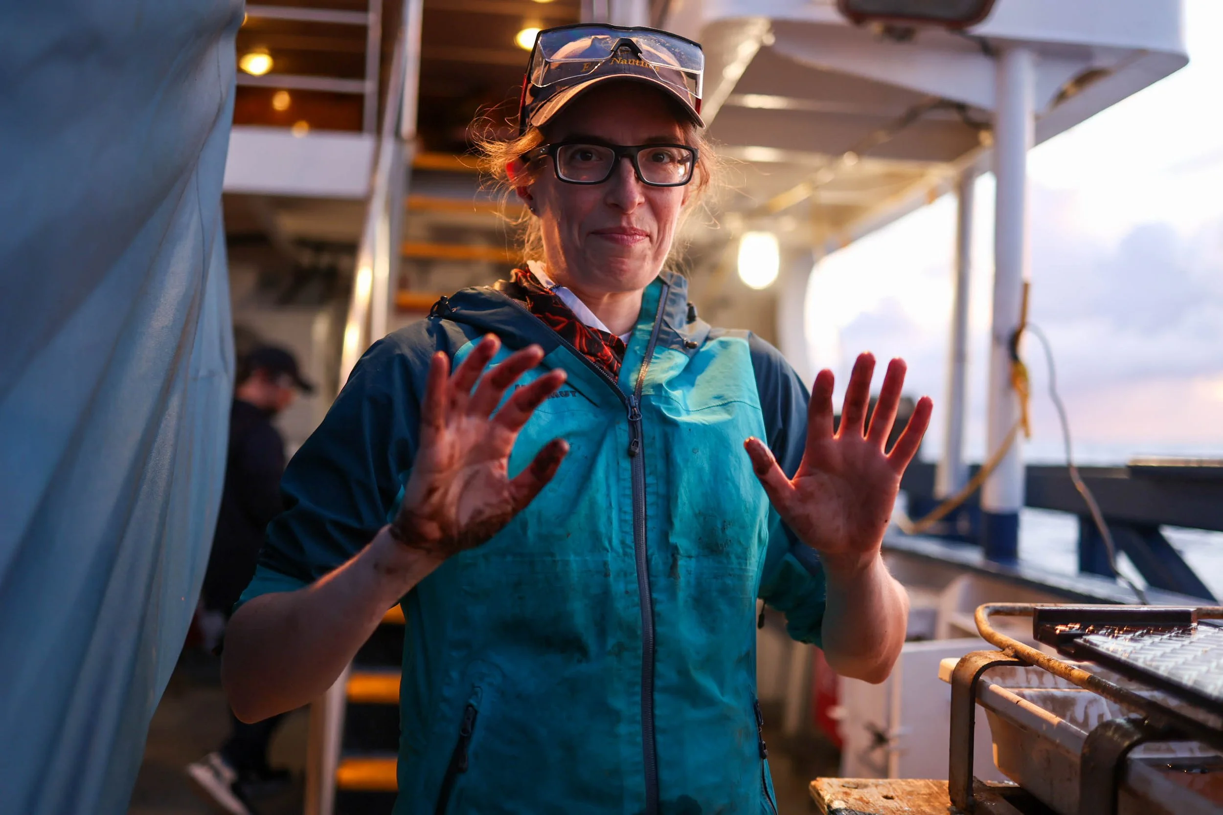
Get your hands dirty: Val has always loved the hands-on nature of field work.
Another challenge: operating a rock saw on a moving ship. This part of the job requires a delicate dance of strategy and safety – and sometimes a hammer and chisel. Val follows proper protocols, donning safety goggles and ensuring the rock is as stable as possible before turning on the saw. The process often involves getting soaked with seawater and splattered with mud, but when the rock is finally cut in half, Val is always smiling.
“It’s like opening up a gift,” she says. “You don’t know what’s under that ferromanganese crust. Sometimes I have a pretty good idea of what’s in there, sometimes the rocks throw a surprise at us – there’s always some anticipation.”
Right now Val has just cut open a rock with two distinct lithologies. On the left is classic basalt, but the lower right portion contains a carbonate conglomerate. She tells me it is most likely a fragment of a basalt flow that had a lot of sediment deposited on top of it and then it all lithified, solidified together before eventually fragmenting.
“Once you get a chance to take a look at what the rock is actually doing inside… there’s always a story.”

A tale of two rocks: Val believes these two distinct rock types (igneous on the left, sedimentary on the right) likely melded together when sediment was deposited on top of an active lava flow.
In the case of the Pacific Ocean Basin, the story is complicated.
I’m sitting on the social deck with Val when she pulls up a topographic map of the Pacific Ocean on her laptop, pointing out the ragged line of terrain that stretches from Hawaii to Kamchatka, Russia. This suture across the Pacific is well-known in the geophysical science community as the Hawaiian-Emperor chain, or the “archetypal” hotspot chain. It's a classic example of a linear series of volcanoes formed from a tectonic plate moving over a stationary hotspot in the Earth's mantle.
“We have a bunch of these hotspots in the Pacific,” Val says. “And the western Pacific is an area where a lot of those tracks left behind from those hotspots overlap.”
Val traces her finger along the Rurutu-Arago hotspot near French Polynesia where she did her PhD research. Then we examine the Rarotonga hotspot, which may have formed the Ralik Chain of the Marshall Islands – where we’re currently operating.
These hotspots (and the many others that span the Pacific) vary widely in age: Rarotonga is estimated to be just over a million years old, the Hawaiian-Emperor chain is 80 million years old, and Rurutu-Arago is 120 million years old.
“Looking at these parallel chains of seamounts that get progressively older got us thinking that maybe all the hotspots are staying still inside the earth and the plates are moving over them.”
Deciphering the dynamics of volcanoes that erupted millions of years ago is difficult, to say the least.
“Working on such old and altered rocks is really challenging,” Val says. “But I think it’s fun.”

A topographic view of the Pacific Ocean floor: the area of operations for our expedition is highlighted by the orange circle. Source: National Geographic Atlas of the World
After making the initial cuts into her rock samples, Val slices off smaller, more precise pieces to use for different types of analysis.
“I will take a slab out of what appears to be the least altered material,” she says. “And from there I will slice off a thinner piece that I can make the size of a microscope slide.”
At the conclusion of our expedition, Val will send those off to a petrographic thin section company to make multiple microscope slides. Those will allow her to get a closer look at textures, determine the condition of the minerals, and figure out which samples are suitable for different kinds of analysis back in the lab.
Val’s work contains this fundamental dichotomy: big and small. On the one hand, her research is mind-boggling massive, spanning across thousands of miles and millions of years. But on the other hand, she parses out infinitesimal measurements of elements.
“You need really high resolution and really high precision to see some variation in these different isotope ratios,” Val explains. “Those differences give us information about where these volcanoes came from inside the earth.”
Assuming the hot spots of the Pacific remain more or less fixed in one place, Val and her colleagues can use them to establish an absolute reference frame (for folks who aren’t physicists, that means a fixed point from which all motion can be measured.)
The challenge is that very few things on a tectonically active planet stay in one place forever.
“When we compare them, we do find some evidence of movement of the hotspots,” Val says. “But on the whole, they are more or less in the same area… we think.”
She throws up her hands. “If this stuff were easy, it would have been done already.”
For now, let’s say the hot spots are staying put and the Pacific plate is moving. From that perspective, geophysicists can generate models that illustrate the tectonic history of this part of the planet, predict where some of these hotspot tracks might have been, and where other particular seafloor features might have formed.
“It gives us the ability to reconstruct the tectonic history of the Pacific and understand how an ocean basin can form and evolve over time,” Val says.
This is not the first time I’ve taken a deep dive into the geophysical history of the seafloor, but it still blows my mind.
“That is so amazing.”
“Yeah,” Val says, nodding. “It really is.”
The only thing more amazing than Val’s ability to interpret clues from the formation of the Pacific Ocean Basin is our team’s enthusiasm for her work.
People often gather onto the social deck to watch Val cutting rocks on the deck below. “It’s rock-o’clock!” has become a popular refrain around the ship. Whether she’s talking on SPL during a dive or discussing her research over dinner, we all enjoy hearing Val share her expertise.
But the geology zeal hits a fever pitch one evening after dinner when the quiet, end-of-the-day lull is interrupted by Matt Holden bursting into the mess.
“You guys have to COME SEE THIS!” he shrieks with delight. “It’s a rock from the seafloor that GLOWS IN THE DARK!”
Sound the nerd alert! The sleepy energy of the room evaporates as everyone rises, rushes downstairs, and crowds into the Wet Lab.
There, Val shines her UV light onto a recently sliced-open rock, giving it a slightly alien purple hue. When she clicks the light off, the white veins of the rock glow green for a few seconds.
As best Val can tell, we’re looking at fragmented lava suspended in lithified sediment. When exposed to UV light, the sediment phosphoresces.
“This glow-in-the-dark effect tells us that the sediment is made out of calcite and/or a phosphate material.”
I wait for everyone to finish snapping photos and videos with their iPhones, then I move closer with my camera.
“Is this the first time you’ve seen this?” I ask.
Val shakes her head. “This is only the second time I’ve brought a UV light out to sea with me… for all I know, there could be tons of rocks on the seafloor that do this.”

A cheerleader for science: Matt Holden holds up a freshly cut sample on the back deck.

Behold the glow. This little lava fragment generated quite the buzz on board.
When we’re not talking about geology, Val and I dig into other topics: the best strategies for communicating science, the unique nature of life at sea, and the value of being adaptable.
“There is a lot of painstaking detail in this work, and there are so many different skills you have to learn,” she says. “But I need all those different little things, otherwise I would get bored.”
I nod. “Yeah, it’s good to change it up.”
“I’m never bored,” Val says. “Every time I come back out to sea, I’ve got a new idea or new strategy for sampling or characterization. How can I get better at x or y? How can I improve sample descriptions? What can I do with what I have? It forces you to be resourceful.”
In the same way that Val is always adapting her techniques at sea, she is constantly looking for ways to be a better communicator and advocate for science. There are many reasons why our shipmates constantly cheer for Val. She is willing to explain complicated concepts over and over again. She teaches our interns how to use the rock saw. She invites me (and others) to take photos and she patiently answers all of our questions. But most importantly, she is kind and approachable.
When I share some of these observations with Val, she blushes slightly, but she doesn’t rebuff the praise.
“During my first research expedition, back in 2013, I saw early on that being a good citizen of the ship comes first,” she says. “Morale is the most important thing.”

Nerds unite! Val poses for a photo on the “front porch” of ROV Hercules with Science Communication Fellow Giselle De Leon.
By the time our final ROV dive wraps up, Val’s corner of the Wet Lab contains 30 rock samples. She has logged, labeled, cut, and sorted all of them. From here, Val will ship them to three different locations. The main archival samples will go to the Marine Geological Samples Laboratory in the Graduate School of Oceanography at the University of Rhode Island. The sub-samples will be split between Val’s home institution, the University of Maryland, as well as Oregon State University, the home base of Val’s long-time collaborator, Kevin Konrad.
As they have done many times before, Val and Kevin will work closely to develop a joint sample analysis plan. From different pieces of the same rock, Kevin will determine the age while Val will handle all the isotope geochemistry, as well as pinpoint major and trace element composition. Then they will pull all that information together as an integrated and highly detailed data set on each sample.
“All of those data points amalgamated together over time and space are so valuable,” Val says. “It gives us a really dynamic history of what’s going on in this little bit of mantle.”
Val has her work cut out for her, but right now she is a happy scientist.
“I’m really proud of what we did out here,” she says. “Before this expedition, this was an area where we had just a few data points – so I’ll be able to fill in that gap in the story.”
After spending so much time chatting with Val about the geophysical history of the Pacific, it feels strange to ask her about the future.
“Do you think you’ll still be working on this stuff ten or twenty years from now?”
Val knocks her fist on the teak table.
“I hope so,” she says. “If I had unlimited resources, I would train students and keep this kind of research going for as long as possible.”
Val tells me there aren’t many American scientists working in this specific area right now. She would love to see more people get involved – especially younger people – to bring some new ideas and fresh perspectives to the table.
I wonder about geologic questions in other parts of the world. There are so many fascinating places on the planet that we don’t fully understand. If Val had all the funding and support she needed, would she work in other locations?
Nope. This globe-trotting geochemist has found her place.
“If I could, I would spend the rest of my life working on this stuff,” Val says.
She peers down, as if she can see through the bottom of the ship, through thousands of feet of saltwater, to the seafloor. Perhaps all the way down into the earth’s crust – to the enigmatic mantle.
She looks up. “I would stay right here.”

A prolific scientist in her happy place. NA174 marked Val’s eigth research expedition in the Pacific Ocean. She hopes it will be one of many more in her career.
Learn more about Val’s work here: University of Maryland Isotope Geochemistry Laboratory